Difference between revisions of "Loutrochori (Pella)"
| Line 1: | Line 1: | ||
| − | {| border="0" cellpadding="2" cellspacing="1" style="float:right; empty-cells:show; margin-left:1em; margin-bottom:0.5em; background:# | + | {| border="0" cellpadding="2" cellspacing="1" style="float:right; empty-cells:show; margin-left:1em; margin-bottom:0.5em; background:#5050FF" |
| − | ! colspan="2" bgcolor="# | + | ! colspan="2" bgcolor="#5050FF" | [[Loutrochori|<span style="color: yellow;">Loutrochori]]<br>'''[[Loutrochori|<span style="color: yellow;">Λουτροχώρι]]''' |
|- style="background: #ffffff;" | |- style="background: #ffffff;" | ||
|valign="top"|Country: || [[Greece]] | |valign="top"|Country: || [[Greece]] | ||
| Line 19: | Line 19: | ||
|- style="background: #ffffff;" | |- style="background: #ffffff;" | ||
|valign="top"|Elevation: | |valign="top"|Elevation: | ||
| − | |valign="top"|86 (282 ft) m | + | |valign="top"|59-86 (282 ft) m |
|- style="background: #ffffff;" | |- style="background: #ffffff;" | ||
|valign="top" rowspan="1"|Population: | |valign="top" rowspan="1"|Population: | ||
| Line 37: | Line 37: | ||
|} | |} | ||
| − | '''Loutrochori(on)''' ([[Greek language|Greek]]: '''Λουτροχώρι(οv)''', 'bath town'), formerly Bania Μπάνια 'baths', is a [[List of settlements in the Pella prefecture|village]] in the [[Pella prefecture]], of [[Macedonia]] in [[Greece]]. It is located at [http://www.european-spas-health-resorts.com/town/greece/loutrochori-skydra/ 40.72306° N 22.10917° E]. | + | '''Loutrochori(on)''' ([[Greek language|Greek]]: '''Λουτροχώρι(οv)''', 'bath town'), formerly Bania Μπάνια 'baths', is a [[List of settlements in the Pella prefecture|village]] in the [[Pella prefecture]], of [[Macedonia]] in [[Greece]]. It is located at [http://www.european-spas-health-resorts.com/town/greece/loutrochori-skydra/ 40.72306° N 22.10917° E]. According to the 2001 census, population was is 466 <ref>2001 Census, National Statistical Service of Greece (ΕΣΥΕ), ([http://www.statistics.gr/gr_tables/S1101_SAP_1_TB_DC_01_03_Y.pdf PDF] 875 KB)</ref>, area is 3.96 square kilometers, and population density is 118 per square kilometers. |
| − | |||
==History== | ==History== | ||
| Line 55: | Line 54: | ||
Loutrochori is part of the municipality of [[Skydra]]. It is 23 km southwest of the prefectural capital of [[Edessa]] in [[Macedonia|Central Macedonia]], (Greece). Loutrochori is bounded with the prefecture of [[Imathia]] to the southwest. It sits at an elevation of around 90 meters above mean sea level and the population is approximately from 500 (in winter) to 800 (in summer) inhabitants. | Loutrochori is part of the municipality of [[Skydra]]. It is 23 km southwest of the prefectural capital of [[Edessa]] in [[Macedonia|Central Macedonia]], (Greece). Loutrochori is bounded with the prefecture of [[Imathia]] to the southwest. It sits at an elevation of around 90 meters above mean sea level and the population is approximately from 500 (in winter) to 800 (in summer) inhabitants. | ||
| − | === | + | Like some of its sister municipalities and towns, Loutrochori is blessed with beautiful surroundings and a unique natural setting. The picturesque scenery, the majesty of nature, the slow pace of life, and the welcoming nature of its people all combine to make this region one of the most important tourist attractions in Europe. |
| + | |||
| + | ===Climate=== | ||
| + | Loutrochori has a [[Mediterranean climate]] with mild, rainy winters and hot, dry summers. | ||
| − | + | {| class="wikitable" style="font-size:90%;width:100%;border:0px;text-align:center;line-height:120%;" | |
| + | ! style="background: #99CCCC; color: #000080" height="17" |'''[[Month]]''' | ||
| + | ! style="background: #99CCCC; color:#000080;" | Year | ||
| + | ! style="background: #99CCCC; color:#000080;" | Jan | ||
| + | ! style="background: #99CCCC; color:#000080;" | Feb | ||
| + | ! style="background: #99CCCC; color:#000080;" | Mar | ||
| + | ! style="background: #99CCCC; color:#000080;" | Apr | ||
| + | ! style="background: #99CCCC; color:#000080;" | May | ||
| + | ! style="background: #99CCCC; color:#000080;" | Jun | ||
| + | ! style="background: #99CCCC; color:#000080;" | Jul | ||
| + | ! style="background: #99CCCC; color:#000080;" | Aug | ||
| + | ! style="background: #99CCCC; color:#000080;" | Sep | ||
| + | ! style="background: #99CCCC; color:#000080;" | Oct | ||
| + | ! style="background: #99CCCC; color:#000080;" | Nov | ||
| + | ! style="background: #99CCCC; color:#000080;" | Dec | ||
| + | |- | ||
| + | ! style="background: #99CCCC; color: #000080;" height="17" |Avg high °C (°F) -Maximum. | ||
| + | | style="background: #FFCC66; color:#000080;" | 19,5 (67) | ||
| + | | style="background: #FFFF99; color:#000080;" | 7 (44) | ||
| + | | style="background: #FFFF99; color:#000080;" | 9 (48) | ||
| + | | style="background: #FFCC66; color:#000080;" | 14 (57) | ||
| + | | style="background: #FFCC66; color:#000080;" | 18 (64) | ||
| + | | style="background: #FFCC00; color:#000080;" | 24 (75) | ||
| + | | style="background: #FF9900; color:#000080;" | 29 (84) | ||
| + | | style="background: #FF9900; color:#000080;" | 31 (88) | ||
| + | | style="background: #FF9900; color:#000080;" | 32 (90) | ||
| + | | style="background: #FFCC00; color:#000080;" | 27 (81) | ||
| + | | style="background: #FFCC00; color:#000080;" | 22 (71) | ||
| + | | style="background: #FFFF66; color:#000080;" | 14 (55) | ||
| + | | style="background: #FFFF99; color:#000080;" | 8 (46) | ||
| + | |- | ||
| + | | style="background: #99CCCC; color: #000080;" height="17" |'''Avg low temperature °C (°F) -Minimum.''' | ||
| + | | style="background: #FFFF99; color: black;" | 10 (50) | ||
| + | | style="background: #FFFFCC; color: black;" | 1 (34) | ||
| + | | style="background: #FFFFCC; color: black;" | 3 (37) | ||
| + | | style="background: #FFFF99; color: black;" | 6 (43) | ||
| + | | style="background: #FFFF99; color: black;" | 8 (47) | ||
| + | | style="background: #FFFF66; color: black;" | 12 (54) | ||
| + | | style="background: #FFCC00; color: black;" | 17 (62) | ||
| + | | style="background: #FFCC00; color: black;" | 19 (66) | ||
| + | | style="background: #FFCC00; color: black;" | 18 (64) | ||
| + | | style="background: #FFFF66; color: black;" | 15 (59) | ||
| + | | style="background: #FFFF66; color: black;" | 12 (54) | ||
| + | | style="background: #FFFF99; color: black;" | 6 (43) | ||
| + | | style="background: #FFFFCC; color: black;" | 3 (37) | ||
| + | |- | ||
| + | | style="background: #99CCCC; color: #000080;" height="17" |'''Rainfall (mm)''' | ||
| + | | style="background: #66CCFF; color: black;" | 40 | ||
| + | | style="background: #66CCFF; color: black;" | 43 | ||
| + | | style="background: #0033FF; color: black;" | 51 | ||
| + | | style="background: #66CCFF; color: black;" | 45 | ||
| + | | style="background: #66FFFF; color: black;" | 35 | ||
| + | | style="background: #66CCFF; color: black;" | 41 | ||
| + | | style="background: #80FFFF; color: black;" | 28 | ||
| + | | style="background: #80FFFF; color: black;" | 27 | ||
| + | | style="background: #80FFFF; color: black;" | 23 | ||
| + | | style="background: #66FFFF; color: black;" | 34 | ||
| + | | style="background: #66CCFF; color: black;" | 39 | ||
| + | | style="background: #0033FF; color: black;" | 51 | ||
| + | | style="background: #0033FF; color: black;" | 53 | ||
| + | |- | ||
| + | | style="background: #99CCCC; color: #000080;" height="17" |'''Record temperatures °C (°F)''' | ||
| + | | style="background: #FFCC00;" | 31 (88) | ||
| + | | style="background: #FFFF99;" | 19 (66) | ||
| + | | style="background: #FFFF99;" | 22 (72) | ||
| + | | style="background: #FFCC66;" | 26 (79) | ||
| + | | style="background: #FFCC00;" | 32 (90) | ||
| + | | style="background: #FF9900;" | 38 (100) | ||
| + | | style="background: #FF9900;" | 40 (104) | ||
| + | | style="background: #FF9900;" | 41 (106) | ||
| + | | style="background: #FF9900;" | 42 (108) | ||
| + | | style="background: #FFCC00;" | 34 (93) | ||
| + | | style="background: #FFCC00;" | 31 (88) | ||
| + | | style="background: #FFCC66;" | 25 (77) | ||
| + | | style="background: #FFFF99;" | 22 (72) | ||
| + | |- | ||
| + | | colspan="14" style="text-align:center;font-size:90%;"|''Source: [http://www.fallingrain.com/world/GR/7/Loutrochorion.html Fallingrain] and [http://www.multimap.com/maps/?&t=l&map=40.7230555556,22.1091666667|13|4&loc=GR:40.7230555556:22.1091666667:13#t=l&map=40.71939,22.11467|12|4&loc=GR:40.7230555556:22.1091666667:13 Multimap]'' | ||
| + | |} | ||
| + | ==Economy== | ||
| + | Loutrochori produces [[cherry|cherries]] and [[peach]]es and it is listed as one of the best fruit producers in Greece. The village also produces [[apple]]s and some [[strawberry|strawberries]]. | ||
| − | + | ==Demographics== | |
| − | + | (<small>''Statistics, [[1981]]-[[2001]]''</small>) | |
{| border="3" cellspacing="3" cellpadding="3" | {| border="3" cellspacing="3" cellpadding="3" | ||
| − | | style="background: #99CCCC; color: #000080" align="center" colspan="1" height="15"|''' | + | | style="background: #000080" color: #99CCCC; align="center" colspan="1" height="15"|'''[[Year|<span style="color: yellow;">Year]]''' |
| − | | style="background: #99CCCC; color: #000080" align="center" colspan="1" height="15"|''' | + | | style="background: #000080" color: #99CCCC; align="center" colspan="1" height="15"|'''[[Population|<span style="color: yellow;">Population]]''' |
| − | | style="background: #99CCCC; color: #000080" align="center" colspan="1" height="15"|''''' | + | | style="background: #000080" color: #99CCCC; align="center" colspan="1" height="15"|'''''[[Change|<span style="color: yellow;">Change]]''''' |
| + | | style="background: #000080" color: #99CCCC; align="center" colspan="1" height="15"|'''''[[Percentage|<span style="color: yellow;">Percentage]]''''' | ||
| + | | style="background: #000080" color: #99CCCC; align="center" colspan="1" height="15"|'''''[[Density|<span style="color: yellow;">Density]]''''' | ||
| + | | style="background: #000080" color: #99CCCC; align="center" colspan="1" height="15"|'''''<small>[[Skydra|<span style="color: yellow;">Percent of the <br>municipality]]</small>''''' | ||
| + | | style="background: #000080" color: #99CCCC; align="center" colspan="1" height="15"|'''''<small>[[Pella Prefecture|<span style="color: yellow;">Percent of the <br>prefecture]]</small>''''' | ||
| + | | style="background: #000080" color: #99CCCC; align="center" colspan="1" height="15"|'''''<small>[[Greece|<span style="color: yellow;">Percent of <br>Greece]]</small>''''' | ||
|----- | |----- | ||
| − | | style="background: #FFFF99;" | [[1981]] | + | | style="background: #FFFF99;" | [[1981|<span style="color: blue;">1981]] |
| style="background: #FFFF99;" | <big>'''772'''</big> | | style="background: #FFFF99;" | <big>'''772'''</big> | ||
| style="background: #FFFF99;" | ''---'' | | style="background: #FFFF99;" | ''---'' | ||
| + | | style="background: #FFFF99;" | ''---'' | ||
| + | | style="background: #FFFF99;" | ''195 /km²'' | ||
| + | | style="background: #FFFF99;" | ''≈ 6.05%'' | ||
| + | | style="background: #FFFF99;" | ''≈ 0.58%'' | ||
| + | | style="background: #FFFF99;" | ''≈ 0.0080%'' | ||
|----- | |----- | ||
| − | | style="background: #FFFF99;" | [[1991]] | + | | style="background: #FFFF99;" | [[1991|<span style="color: blue;">1991]] |
| − | | style="background: #FFFF99;" | <big>'''483'''</big> | + | | style="background: #FFFF99;" | <big>'''483'''</big> |
| − | | style="background: #FFFF99;" | ''- | + | | style="background: #FFFF99;" | ''- 289'' |
| + | | style="background: #FFFF99;" | ''- 37,43%'' | ||
| + | | style="background: #FFFF99;" | ''122 /km²'' | ||
| + | | style="background: #FFFF99;" | ''≈ 3.47%'' | ||
| + | | style="background: #FFFF99;" | ''≈ 0.35%'' | ||
| + | | style="background: #FFFF99;" | ''≈ 0.0048%'' | ||
|----- | |----- | ||
| − | | style="background: #FFFF99;" | [[2001]] | + | | style="background: #FFFF99;" | [[2001|<span style="color: blue;">2001]] |
| style="background: #FFFF99;" | <big>'''466'''</big> | | style="background: #FFFF99;" | <big>'''466'''</big> | ||
| − | | style="background: #FFFF99;" | ''- | + | | style="background: #FFFF99;" | ''- 17'' |
| + | | style="background: #FFFF99;" | ''- 3,52 %'' | ||
| + | | style="background: #FFFF99;" | ''118 /km²'' | ||
| + | | style="background: #FFFF99;" | ''≈ 3.01%'' | ||
| + | | style="background: #FFFF99;" | ''≈ 0.32%'' | ||
| + | | style="background: #FFFF99;" | ''≈ 0.0043%'' | ||
|} | |} | ||
| + | After the [[World War II|Second World War]], the population steadily declined as residents moved to larger towns and cities and the richest countries in the world. | ||
| − | == | + | ==Locations== |
| − | === | + | ===Nearest places=== |
{| border="1" cellspacing="1" cellpadding="1" | {| border="1" cellspacing="1" cellpadding="1" | ||
| style="background: #99CCCC; color: #000080" align="center" colspan="2" height="11"|Place - [[Prefecture]] | | style="background: #99CCCC; color: #000080" align="center" colspan="2" height="11"|Place - [[Prefecture]] | ||
| Line 185: | Line 287: | ||
|} | |} | ||
| − | + | ===Airports close to Loutrochori=== | |
| − | == | + | {| border="3" cellspacing="3" cellpadding="1" |
| − | + | | style="background: #99CCCC; color: #000080" align="center" colspan="1" height="25"|'''Airport''' | |
| − | {| | + | | style="background: #99CCCC; color: #000080" align="center" colspan="1" height="15"|'''[[International Air Transport Association airport code|IATA]]/[[International Civil Aviation Organization airport code|ICAO <small><small>code</small></small>]]''' |
| − | + | | style="background: #99CCCC; color: #000080" align="center" colspan="1" height="15"|'''''City''''' | |
| − | + | | style="background: #99CCCC; color: #000080" align="center" colspan="1" height="15"|'''''Country''''' | |
| − | + | | style="background: #99CCCC; color: #000080" align="center" colspan="1" height="11"|'''''Distance (km)''''' | |
| − | + | |----- | |
| − | + | | style="background: #FFFF99;" | [[Alexandreia Airport|Alexandreia]] | |
| − | + | | style="background: #FFFF99;" | <small>''-----'' / ''LGAX''</small> | |
| − | + | | style="background: #FFFF99;" | [[Alexandreia]] | |
| − | + | | style="background: #FFFF99;" | [[Greece]] | |
| − | + | | style="background: #FFFF99;" | '''39,8''' | |
| − | + | |----- | |
| − | + | | style="background: #FFFF99;" | '''[[Kozani National Airport "Filippos"|Filippos]]''' | |
| − | + | | style="background: #FFFF99;" | <small>''[[KZI]]'' / ''LGKZ''</small> | |
| − | + | | style="background: #FFFF99;" | [[Kozani]] | |
| − | + | | style="background: #FFFF99;" | [[Greece]] | |
| − | + | | style="background: #FFFF99;" | '''64,6''' | |
| − | + | |----- | |
| − | + | | style="background: #FFFF99;" | '''<big>[[Thessaloniki International Airport, "Macedonia"|M a c e d o n i a]]</big>''' | |
| − | | | + | | style="background: #FFFF99;" | '''[[SKG]]''' / '''LGTS''' |
| − | | style="background: #FFFF99 | + | | style="background: #FFFF99;" | '''[[Thessaloniki]]''' |
| − | | | + | | style="background: #FFFF99;" | '''[[Greece]]''' |
| − | | style="background: # | + | | style="background: #FFFF99;" | '''91,9''' |
| − | | style="background: # | + | |----- |
| − | | style="background: # | + | | style="background: #FFFF99;" | '''[[Kastoria National Airport|Aristotelis]]''' |
| − | | style="background: # | + | | style="background: #FFFF99;" | <small>''[[KSO]]'' / ''LGKA''</small> |
| − | | | + | | style="background: #FFFF99;" | [[Kastoria]] |
| − | | style="background: # | + | | style="background: #FFFF99;" | [[Greece]] |
| − | + | | style="background: #FFFF99;" | '''92,5''' | |
| − | + | |----- | |
| − | | style="background: #FFFF99 | + | | style="background: #FFFF99;" | [[Larissa Airport "Thessaly"|Thessaly]] |
| − | + | | style="background: #FFFF99;" | <small>''[[LRA]]'' / ''LGLR''</small> | |
| − | + | | style="background: #FFFF99;" | [[Larissa]] | |
| − | | style="background: #FFFF99 | + | | style="background: #FFFF99;" | [[Greece]] |
| − | | style="background: # | + | | style="background: #FFFF99;" | '''148,5''' |
| − | + | |----- | |
| − | | style="background: #FFFF99 | + | | style="background: #FFFF99;" | [[Ohrid Airport|Ohrid]] |
| − | | | + | | style="background: #FFFF99;" | <small>''[[OHD]]'' / ''LWOH''</small> |
| − | | style="background: # | + | | style="background: #FFFF99;" | [[Ohrid]] |
| − | + | | style="background: #FFFF99;" | [[FYROM]] | |
| − | + | | style="background: #FFFF99;" | '''151,1''' | |
| − | | style="background: # | + | |----- |
| − | | style="background: # | + | | style="background: #FFFF99;" | [[Stefanovikio National Airport|Stefanovikeio]] |
| − | | style="background: # | + | | style="background: #FFFF99;" | <small>''-----'' / ''LGSV''</small> |
| − | | style="background: #FFFF99 | + | | style="background: #FFFF99;" | <small>[[Karla, Greece|Stefanovikeio]], [[Volos]]</small> |
| − | + | | style="background: #FFFF99;" | [[Greece]] | |
| − | |- | + | | style="background: #FFFF99;" | '''180,1''' |
| − | | style="background: # | + | |----- |
| − | | style="background: # | + | | style="background: #FFFF99;" | '''[[Kavala International Airport|Alexander The Great]]''' |
| − | | style="background: # | + | | style="background: #FFFF99;" | <small>''[[KVA]]'' / ''LGKV''</small> |
| − | | style="background: # | + | | style="background: #FFFF99;" | [[Kavala]] |
| − | | style="background: # | + | | style="background: #FFFF99;" | [[Greece]] |
| − | | | + | | style="background: #FFFF99;" | '''228,6''' |
| − | | style="background: # | ||
| − | |||
| − | | style="background: # | ||
| − | | style="background: # | ||
| − | | style="background: # | ||
| − | | style="background: # | ||
| − | | | ||
| − | | style="background: # | ||
| − | | | ||
| − | | style="background: # | ||
| − | | style="background: # | ||
| − | | style="background: #FFFF99;" | | ||
| − | | style="background: #FFFF99;" | | ||
| − | | style="background: # | ||
| − | | style="background: # | ||
| − | | style="background: # | ||
| − | | style="background: # | ||
| − | | style="background: # | ||
| − | | | ||
| − | | style="background: # | ||
| − | | style="background: # | ||
| − | | style="background: # | ||
| − | | style="background: #FFFF99;" | | ||
| − | | | ||
| − | |||
|} | |} | ||
| − | |||
| − | |||
| − | |||
| − | |||
| − | |||
| − | |||
| − | |||
| − | |||
===Spa and mineral waters of Loutrochori=== | ===Spa and mineral waters of Loutrochori=== | ||
| Line 282: | Line 351: | ||
[http://www.europeanbeautycollection.com/brands/red_water/ Red Water, from the Loutrochori Spring in Greece] | [http://www.europeanbeautycollection.com/brands/red_water/ Red Water, from the Loutrochori Spring in Greece] | ||
| + | |||
| + | ==References== | ||
| + | <references /> | ||
== External links == | == External links == | ||
| + | *[http://www.gtp.gr/LocPage.asp?ID=7435 Loutrochori on GTP Travel Pages (Community)] | ||
| + | *[http://nona.net/features/map/placedetail.739210/Loutroch%C3%B3rion/ Loutrochórion (Pélla, Macedonia, Greece)] | ||
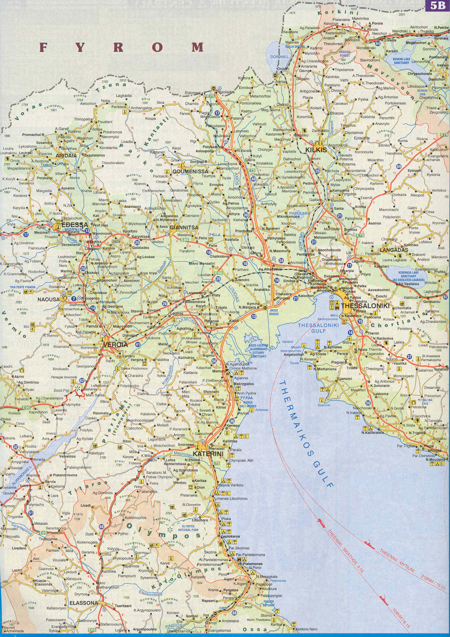
| + | *[http://www.hri.org/info/maps/macedonia-5b.jpg Map of Central Macedonia. - Loutrochori NW (20)] | ||
| + | *[http://epigraphy.packhum.org/inscriptions/oi?ikey=150588&caller=gis&bookid=124®ion=4 Loutrochori (<small>epigraphy, Delacoulonche 242,24</small>)] | ||
*[http://www.indexmundi.com/z/?lat=40.7230556&lon=22.1091667&t=p&r=6340&p=loutrochorion&cc=gr&c=greece Panorama of Loutrochori] | *[http://www.indexmundi.com/z/?lat=40.7230556&lon=22.1091667&t=p&r=6340&p=loutrochorion&cc=gr&c=greece Panorama of Loutrochori] | ||
*[http://www.hoteladonis.gr/en/images/zoom/DSC_0082.jpg A fish pond in Loutrochori] | *[http://www.hoteladonis.gr/en/images/zoom/DSC_0082.jpg A fish pond in Loutrochori] | ||
| Line 289: | Line 365: | ||
*[http://nona.net/features/map/placedetail.739210/Loutroch%C3%B3rion/ Loutrochórion (Pélla, Macedonia, Greece)] | *[http://nona.net/features/map/placedetail.739210/Loutroch%C3%B3rion/ Loutrochórion (Pélla, Macedonia, Greece)] | ||
*[http://epigraphy.packhum.org/inscriptions/gis?region=4&subregion=11&area=Bottiaia&site=Skydra&subsite=Loutrochori Loutrochori (Miscellaneous Books)] | *[http://epigraphy.packhum.org/inscriptions/gis?region=4&subregion=11&area=Bottiaia&site=Skydra&subsite=Loutrochori Loutrochori (Miscellaneous Books)] | ||
| − | + | ||
| − | + | ||
| + | {| width ="75%" border = 2 align="center" | ||
| + | |- | ||
| + | | width ="37%" align="center" | '''Northwest''': [[Rizarion (Pella), Greece|Rizari]], [[Kesariana]] | ||
| + | | width ="26%" align="center" | '''North''': [[Sevastiana]] | ||
| + | | width ="37%" align="center" | '''Northeast''': [[Rizo (Pella), Greece|Rizo]], [[Skydra]] | ||
| + | |- | ||
| + | | width ="37%" align="center" | '''West''': [[Agia Fotini]], [[Polla Nera (Imathia), Greece|Polla Nera]] | ||
| + | | width ="26%" align="center" | Loutrochori | ||
| + | | width ="37%" align="center" | '''East''': [[Petrea (Pella), Greece|Petrea]], [[Arsenio, Greece|Arseni]] | ||
| + | |- | ||
| + | | width ="37%" align="center" | '''Southwest''': [[Rodochori (Imathia), Greece|Rodochori]], [[Gianakochori (Imathia), Greece|Gianakochori]] | ||
| + | | width ="26%" align="center" | '''South:''' [[Marina (Imathia), Greece|Marina]] | ||
| + | | width ="37%" align="center" | '''Southeast''': [[Plevroma]], [[Episkopi (Naoussa), Greece|Episkopi]] | ||
| + | |} | ||
[[Category:Pella prefecture]] | [[Category:Pella prefecture]] | ||
[[Category:Cities and towns in Greece]] | [[Category:Cities and towns in Greece]] | ||
Revision as of 18:44, October 5, 2007
| Loutrochori Λουτροχώρι | |
|---|---|
| Country: | Greece |
| Region: | Macedonia |
| Periphery: | Central Macedonia |
| Prefecture (Nomos): | Pella |
| Municipality (Dimos): | Skydra |
| Coordinates: | 40°43′N 22°6′E |
| Elevation: | 59-86 (282 ft) m |
| Population: | 466 (2001) |
| Area code: | 23810 |
| Postal code: | 585 00 |
| Licence plate code: | (GR) EE |
| Website: | Elementary School of Loutrochori Kindergarten of Loutrochori |
Loutrochori(on) (Greek: Λουτροχώρι(οv), 'bath town'), formerly Bania Μπάνια 'baths', is a village in the Pella prefecture, of Macedonia in Greece. It is located at 40.72306° N 22.10917° E. According to the 2001 census, population was is 466 [1], area is 3.96 square kilometers, and population density is 118 per square kilometers.
History
Ancient era
The Loutrochori area has been a spa from the 4th century BC under the Macedonian Kingdom.
Modern era
Modern Loutrochori is a relatively new village (c. 100 years old).
Geography
Loutrochori is part of the municipality of Skydra. It is 23 km southwest of the prefectural capital of Edessa in Central Macedonia, (Greece). Loutrochori is bounded with the prefecture of Imathia to the southwest. It sits at an elevation of around 90 meters above mean sea level and the population is approximately from 500 (in winter) to 800 (in summer) inhabitants.
Like some of its sister municipalities and towns, Loutrochori is blessed with beautiful surroundings and a unique natural setting. The picturesque scenery, the majesty of nature, the slow pace of life, and the welcoming nature of its people all combine to make this region one of the most important tourist attractions in Europe.
Climate
Loutrochori has a Mediterranean climate with mild, rainy winters and hot, dry summers.
| Month | Year | Jan | Feb | Mar | Apr | May | Jun | Jul | Aug | Sep | Oct | Nov | Dec |
|---|---|---|---|---|---|---|---|---|---|---|---|---|---|
| Avg high °C (°F) -Maximum. | 19,5 (67) | 7 (44) | 9 (48) | 14 (57) | 18 (64) | 24 (75) | 29 (84) | 31 (88) | 32 (90) | 27 (81) | 22 (71) | 14 (55) | 8 (46) |
| Avg low temperature °C (°F) -Minimum. | 10 (50) | 1 (34) | 3 (37) | 6 (43) | 8 (47) | 12 (54) | 17 (62) | 19 (66) | 18 (64) | 15 (59) | 12 (54) | 6 (43) | 3 (37) |
| Rainfall (mm) | 40 | 43 | 51 | 45 | 35 | 41 | 28 | 27 | 23 | 34 | 39 | 51 | 53 |
| Record temperatures °C (°F) | 31 (88) | 19 (66) | 22 (72) | 26 (79) | 32 (90) | 38 (100) | 40 (104) | 41 (106) | 42 (108) | 34 (93) | 31 (88) | 25 (77) | 22 (72) |
| Source: Fallingrain and Multimap | |||||||||||||
Economy
Loutrochori produces cherries and peaches and it is listed as one of the best fruit producers in Greece. The village also produces apples and some strawberries.
Demographics
| Year | Population | Change | Percentage | Density | Percent of the municipality |
Percent of the prefecture |
Percent of Greece |
| 1981 | 772 | --- | --- | 195 /km² | ≈ 6.05% | ≈ 0.58% | ≈ 0.0080% |
| 1991 | 483 | - 289 | - 37,43% | 122 /km² | ≈ 3.47% | ≈ 0.35% | ≈ 0.0048% |
| 2001 | 466 | - 17 | - 3,52 % | 118 /km² | ≈ 3.01% | ≈ 0.32% | ≈ 0.0043% |
After the Second World War, the population steadily declined as residents moved to larger towns and cities and the richest countries in the world.
Locations
Nearest places
| Place - Prefecture | km - nm | ||
| Polla Nera | Imathia | 2.0 | 1.5 |
| Plevroma | Pella | 2.0 | 1.5 |
| Rizo | Pella | 2.5 | 1.5 |
| Petrea | Pella | 3.0 | 1.8 |
| Marina | Imathia | 3.1 | 1.9 |
| Arsenio | Pella | 4.5 | 2.7 |
| Episkopi NE of Naousa | Imathia | 4.6 | 2.8 |
| Sevastiana | Pella | 5.1 | 3.1 |
| Kesariana | Pella | 6.1 | 3.7 |
| Skydra the capital of the municipality | Pella | 6.1 | 3.7 |
Big cities
| Cities | km - nm | |
| Naousa | 15 | 9 |
| Edessa | 20 | 12 |
| Veria | 25 | 15 |
| Giannitsa | 33 | 20 |
| Kozani | 83 | 50 |
| Thessaloniki | 86 | 52 |
| Larissa | 187 | 113 |
| Kavala | 253 | 153 |
| Athens | 540 | 326 |
| Constantinople | 683 | 413 |
Airports close to Loutrochori
| Airport | IATA/ICAO code | City | Country | Distance (km) |
| Alexandreia | ----- / LGAX | Alexandreia | Greece | 39,8 |
| Filippos | KZI / LGKZ | Kozani | Greece | 64,6 |
| M a c e d o n i a | SKG / LGTS | Thessaloniki | Greece | 91,9 |
| Aristotelis | KSO / LGKA | Kastoria | Greece | 92,5 |
| Thessaly | LRA / LGLR | Larissa | Greece | 148,5 |
| Ohrid | OHD / LWOH | Ohrid | FYROM | 151,1 |
| Stefanovikeio | ----- / LGSV | Stefanovikeio, Volos | Greece | 180,1 |
| Alexander The Great | KVA / LGKV | Kavala | Greece | 228,6 |
Spa and mineral waters of Loutrochori
Map of Spa of Loutrochori in Greece
Red Water
Red Water, from the Loutrochori Spring in Greece
References
External links
- Loutrochori on GTP Travel Pages (Community)
- Loutrochórion (Pélla, Macedonia, Greece)
- Map of Central Macedonia. - Loutrochori NW (20)
- Loutrochori (epigraphy, Delacoulonche 242,24)
- Panorama of Loutrochori
- A fish pond in Loutrochori
- Satellite photo of Loutrochori
- Loutrochórion (Pélla, Macedonia, Greece)
- Loutrochori (Miscellaneous Books)
| Northwest: Rizari, Kesariana | North: Sevastiana | Northeast: Rizo, Skydra |
| West: Agia Fotini, Polla Nera | Loutrochori | East: Petrea, Arseni |
| Southwest: Rodochori, Gianakochori | South: Marina | Southeast: Plevroma, Episkopi |